Damage to Western Ghats makes Kerala floods worse
Nidheesh M.K. | livemint.com
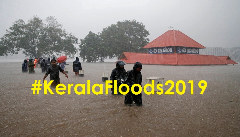
Kerala is recovering from a major flood, exactly a year after being hit by another one. Last year’s floods were described as a once-in-a-century calamity, this one was an ecological disaster waiting to happen.
Along with extremely heavy rain, an analysis of the floods shows that the huge number of deaths in the floods could be linked to the rampant destruction of the Western Ghats, the biodiversity hotspot that covers about half of Kerala.
Experts warn that if the destruction goes on unchecked, future floods could bring even bigger disasters in India’s monsoon gateway
Within a span of just four days since 8 August, the floods have killed an estimated 76 people in Kerala. In neighbouring Karnataka, significantly bigger than Kerala, the toll is 42. Kerala chief minister Pinarayi Vijayan on Sunday admitted that the escalation of deaths is largely the result of a large number of landslides—28 people have been killed in some 83 landslides.
Wherever landslides happened, there were granite quarries on the other side of the hill, according to government data on damages and a recent mapping of Kerala’s granite quarries by T.V. Sajeev, the principal scientist at the Kerala Forest Research Institute.
Although legal, these quarries were allowed to run despite running the risk of landslides; 10 out of the 11 pockets which witnessed major landslides, and where 91 quarries operated, were classified as ecologically sensitive zones and asked to be banned from mining and quarrying by the Western Ghats Ecology Expert Panel, also known the Madhav Gadgil Committee in its report in 2011.
After the Gadgil report was criticized as biased against development, the government constituted another committee, the high-level working group or the Kasturirangan committee, which recommended a reduced zone of protection. But even by the Kasturirangan committee report, five out of these 11 landslide areas should have been banned from mining and quarrying.
Kerala has a total 5,924 quarries, an average of six quarries per panchayat, of which 3,332 are in the ecologically sensitive zones identified by Gadgil, as per Sajeev’s research. In sum, 56% of the quarries are on fragile spots in the Western Ghats, making them prone to landslides.
According to Viju B, author of the just- published Flood and Fury,’ a book on the 2018 floods, the existing regulation largely asks them to be 50m away from residential zones, no matter what kind of land it is— forest or hills or rivers.
In Malappuram district’s Kavalappara, which saw one of the two biggest damages in the rains as a landslide smashed down a hill submerging hundreds of houses in the valley, estimates point out to 27 quarries within a five km radius. This could be a conservative estimate because one quarry shown in the satellite images could actually be five or six on the ground.
In Wayanad’s Meppadi, the other major damage spot where 100 acres of a hilly tea estate were washed away in a landslide, estimates show at least one quarry was operating on the other side of the hill. The damage arising out of this situation is huge for Kerala, with its densely populated rural and urban areas, said Sajeev, over the phone. “The vibrations from these blasts are shaking the hills. Sound waves go fastest in diamonds, and the next in granites. The density variations arising out of quarrying are destroying millennia-old forests in the Western Ghats,” he said.

Wayanad is probably the worst affected district in Kerala by unchecked quarrying and climate change, said Viju .
“Land-use changes mapped by Kerala Forest Research Institute shows Wayanad has lost a forest cover of 1086 square km, an area larger than all of Delhi,” he said.
Massive constructions have destroyed the slope of the hills and changed the course of rivers. “There is a river, Panamaram (in Wayanad). All of its tributaries are reclaimed now, and the water has nowhere to go. The fragmentation of forests is also reflected in human-animal conflict, that has been on a rise. The district has also witnessed a change in temperature of 2-3 degrees, that otherwise happens over centuries, over a short span of years,” he said.
“Behind every landslide, there is an unscientific change of crops, cutting off the slope of the hill, construction, and quarrying. The 2018 floods debate revolved around the huge rains and dam operations. But a third primary reason, ecological destruction of western ghats largely remain undebated,” he said.